Saturday, February 26, 2011

Malaysian Elephants

Rainforest Animals Wild Malaysian Elephants

Malaysian Elephants in Peninsular Malaysia are in same species of Asian Elephant (Elephas Maximus) while its siblings in Sabah Borneo Malaysia is a little bit smaller in size and known as Sabah Pygmy Elephants (Elephas maximus borneensis). Asian Elephants of Peninsular Malaysia, Thailand, Myanmar and India (Mainland Asia Continent) share same characteristic and categorised as Elephas Maximus, other recognized sub categories  are Sumatran Elephants ( Elephas maximus sumatrensis),  Sabah Borneo Pygmy Elephants (Elephas maximus borneensis) and Sri Lankan  Elephants (Elephas Maximus Maximus). Elephants on these islands of Borneo, Sumatra and Sri Langka have distinct characteristic from Asian Elephants and may have seperated from mainland in hundred thousand years ago.  Malaysian elephant or Asian Elephants are much smaller than African Elephants and have distinct different of smaller ear that have staright shape at the bottom. Population of wild Malaysian Elephants in peninsular Malaysia can be found left scattered in isolated forest reserves. Deforestation of Malaysian Rainforest , construction of electrical hydro dam, clearing up of rainforest for plantation and development have cause fragmentation of rainforest and reduce suitable habitat for Malaysian Elephants.  


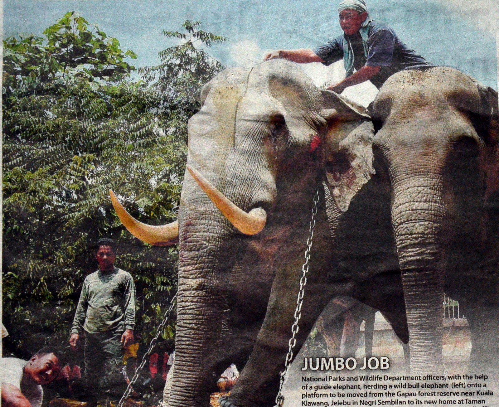
Wild Malaysian Elephant being transfered to National Park after encroaching into Plantation

Habitat and Diet of Malaysian Elephant
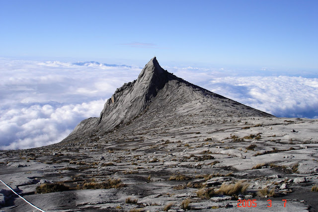
Malaysia Elephants natural habitat is in lowland rainforest below 300m  sea level. Elephant is attracted to moonlight and love to see view of landscape from higher place and It is well known for Malaysian Elephants to climb up to peak of Mountain such as Bintang Mountain, Chamah and Ulu Sepat Mountains in Peninsular Malaysia. Aluminium panels that erected on these peaks used to be uprooted by Malaysian Elephants because it is reflective and attract Elephants' attention. Even with its big size, do not suprise that Elephants could climb with ease. Malaysian Elephants need vast area of lowland rainforest to meet its need for foods and ample space for it to roam, live and breed. Malaysia Elephants are forest herbivores. One adult can eat up to 150 kg of vegetation per day, feeding mostly on species of palms, grasses and wild bananas. In Malaysia Peninsular, Malaysian Elephants can be found in forest reserves around Bintang Mountain Range, Titiwangsa Mountain Range (concentrated especially on the northern forest reserve such as Grik, and Temenggor) , Tahan Mountain Range that lies in Taman Negara National Park (Most of its roam in the area of Tasik Kenyir border and Kuala Tahan / Jerantut), Endau Rompin National Park at south of Malaysia Peninsular and Gapau Forest Reserve in Kuala Klawang Negeri Sembilan. While Sabah Pygmy Elephants largely found in Kinabatangan Valley of Sabah Rainforest.

Ecology of Malaysian Elephants

Social Structure Elephant’s societies are matriarchal, led by a female in small groups. Family groups consist of mothers, daughters, sisters and immature males. An adult male usually remain solitary while sometime join with main herd which is essential for their reproduction and survival. Asian and Malaysian Elephant could live for up to 60 to 80 years. One calf is born at a time and female Asian elephants have about 7 calves in a lifetime. They give birth about every 4 - 6 years and gestation / pregnancy period is between 19-22 months and Elephants Calves suckle for 3 - 4 years. Elephants have very good sense of awareness of its surrounding and good memory. Elephant that is protecting its cub and mating would be very aggressive. Defensive measure should not be taken lightly when entering Elephants area, hikers normally use firecracker to give warning or simply to let the Elephants know that human is in the area thus avoid direct encounter.


Conservation and Sanctuary
Depleted lowland rainforest has draw more encounter between Malaysian Elephants and human. This has become inevitable as human plantation and development has encroaching more and more on elephants habitat thus create human-elephants conflict.  Malaysian Authority has come with several applauble measure such as setting up of Kuala Gandah Elephant Santuactry at Temerloh Pahang through its Wildlife Agency , and Gazetted of several Forest Reserves through out Malaysia. This sanctuary is the only center in Malaysia dedicated to locating, subduing, translucent problem Malaysian Elephants from areas where their habitats are constantly being encroached by plantations, to Malaysia's National Parks such as Taman Negara. This sanctuary also shelter orphan elephant that got separated from its herd and injured elephants. The Role of this sanctuary is essential in managing and controlling the increasing human-elephants conflict that sometime reported in newspaper. Visiting Kuala Gandah Elephant Sanctuary is fun which you have opportunity to get close and personal with these Malaysian Elephants.  

Sabah Pygmy Elephants - from WWF Malaysia

Related Articles:

Saturday, February 19, 2011

Bukit Tabur


Map / Peta to Bukit Tabur West Melawati  Kuala Lumpur


This map is to show direction from Highway MRR2 to starting point of Bukit Tabur trail. From MRR2 exit at junction of jalan Genting Klang and Jalan Kolam Air. Take direction toward Jalan Kolam Air. You have choice whether to  go straight until the end of Jalan Kolam Air or take right to Jalan Taman Melawati until roundabout of Taman Bukit Mas. Take direction of 9 o clock  until reach back Jalan Kolam Air and take right. From here you will notice that the road will be narrower into single lane through housing area and hilly jungle. The road is not so good and you will passing by some small waterfall on your left. The road will end at entry point of Klang Gate Dam. Starting point of Bukit Tabur trail start 20 meter before the Dam's main gate marked by small cement stair. View this map to Bukit Tabur Kuala Lumpur through Google Maps. Choose satelie view for more clear direction.... Wish you all Have a Nice Hiking Trip at Bukit Tabur.


View Bukit Tabor Kuala Lumpur in a larger map


me at Bukit Tabur


Related Articles

Broga Hill

It's quite amazing that A barren Broga Hill with all its original tree burnt, not exactly known cause of the fire whether by accident or simply deforested for agriculture, could transform into a quite unique landscape. What normally happen to rainforest after clearing would never restore itself to its former stage unless it is rehabilitated or just wait for thousand years. It could turn into bush of "resam" (large fern) or field of "lalang" cogon grass (Imperata cylindrica)   like this Broga Hill /Bukit Broga that is why it is also called Bukit lalang . What make this landscape a becoming public attraction is Broga Hill offer view! human love view of landscape, even elephant do. What normally hill with lowland rainforest is full with high canopy tree and thick layer of plants would block view and with temperature / humidity rising with sunrise, I beg not everyone love to be there :) .. Cleared rainforest hill with nice view come with a price, the sun will shine bright directly to you, even pass 9.00am it will becoming harder to handle unless you are a tough nut with hard shell.  Bring an umbrella will not make you like aunty or uncle going to market, moreover others will salute your wisedom he he... Hiking up broga hill is fun. Fun to see many kind of people there, from though and fit mountain climber to excited sissy squid, from baby to old people. All seem to enjoy Broga Hill so will you.. so this map of how to go to Broga Hill aka Bukit Broga, hope will be a beneficial guide to you to go there

From Kuala Lumpur you can take either PLUS highway, exit at Kajang Toll or SILK highway from Cheras to Semenyih. From either route go to Bandar Semenyih. From jalan Semenyih heading to Seremban (old road), look for Raja Muda Mosque on the right, just after Police Station on your left, go straight, 200meter after Petronas Station turn left to Broga at juncntion toward Broga Town. Several km forward you will able to see Broga Hill from afar on your left. Around 2km after University of Nottigham campus look for small patch of palm oil  plantation  on your left and rabbit farm on your right... park your car by roadside or in the plantation for a charge RM2 per entry :) 


View Bukit Broga / Hill Semenyih in a larger map


From Raja Muda Mosque on the right, just after Police Station on your left, go straight, 200meter after Petronas Station then turn left to Broga at juncntion towards Broga Town
If you like hiking on Broga Hill trail you might also like to hike Saga Hill Trail. In contrast from Broga Hill landscape and vegetation of cogon grass (Imperata cylindrica), Saga Hill still have its protected natural lowland and hill dipterocarp rainforest. The rainforest provide complete canopy over the trail. While it is hot on Broga Hill after 9.00am, there at Saga Hill is still envelope with mist and cold breeze.The hill is located at fringe of Kuala Lumpur City Centre is easily accessible through Taman Saga or Taman Ceupacs. One of attraction at Saga Hill is its waterfall. While it is just a small waterfall but is worth it after hours of hiking. Read more about Saga Hill here.


Related Article

Tuesday, February 15, 2011

Maliau Basin

The Lost World of Maliau Basin Tawau Sabah


The Maliau Basin is a place set on a sprawling 588.4 square kilometers land in Tawau, at the South Central Part of Sabah. On south of Mount Kinabalu The area of Maliau Basin is bordered with crater like wall that fall hundred meters down that make it a separated area from the rest of rainforest which is why it's called Maliau "Basin". The isolated habitat has naturally protect its biome  from  human touch for so long until 1981 and nurtured the unique species of fauna and flora that exist there. Because of this condition Maliau Basin got its other name  "The Lost World of Malaiu Basin".


Maliau Basin contains an unusual assemblage of 12 forest types, comprising mainly of lower montane forest dominated by majestic Agathis trees, rare montane heath forest and lowland, and hill diperocarp forest. The highlight of the adventure is to trek the majestic 7 tiers Maliau Falls. 


Keen visitors must, however, obtain a permission to enter the Maliau Basin in advance from Yayasan Sabah. Also bear in mind that Maliau Basin is a remote, atavistic and isolated area with limited access, communications and safety facilities.


Activities & Tariffs

Nature explorers will simply love the Maliau Basin as it is an excellent site for jungle trekking and bird watching. At night, visitors may also take a night drive for wildlife spotting. Water babies can also take a dip in the beautiful waterfall.


Trips to the Maliau Basin are best done in large groups. A 5-day, 4-night stay at Maliau Basin costs RM2730 nett for 2 pax adults (Malaysian) and RM3610 nett (non-Malaysian). For a group of 8 to 12 people, the rate for adults is RM1450 nett (Malaysian) and RM2270 (non-Malaysian).


The rates in Ringgit Malaysia (RM) are inclusive of meals (breakfast, lunch and dinner), returned transfer (overland – Tawau to Agathis Camp), conservation and user fee (Campsites), rental of VHF radio, forest ranger cum radioman and guide.


Sime Darby offer help in SAFE project
Sime Darby has play its part towards environment and rainforest conservation by offering help in SAFE project and at the same time help lifting its Corporate Image as responsible company that know its responsibility towards environment other than enlarging its palm oil plantation at place of rainforest.


Deep in the heart of the Maliau Basin lies a lost world awaiting to be discovered by scientists and thrill-seekers.It is home to the largest ecological experiment ever established in Asia, and dubbed the Stability of Altered Forest Ecosystems (SAFE) project. SAFE is a 10-year project funded by the Sime Darby Foundation in collaboration with the Royal Society- Southeast Asia Rainforest Research Programme (SEARPP) and Sabah Foundation, which manages the Maliau Basin.


The SAFE project basically takes an in-depth look at how biodiversity is affected as forests undergo changes (from a primary forest to an oil palm plantation) which cause disruptions to ecosystem processes and services such as carbon sequestration, decomposition and pollination. And it is a huge task, considering that the Maliau Basin is as big as Singapore -- at 58,840ha. This is also the reason why it will take scientists at least 10 years before they can come up with the findings.


Sime Darby Foundation, which kicked off SAFE in January last year, is taking a big leap of faith in the project as the results may prove or dispel criticisms from environmental proponents that plantations are the destroyers of biodiversity.


Whatever the results, Sime Darby Foundation chairman Tun Musa Hitam, at the launching of SAFE, said they would serve to improve Sime Darby's commitment to conservation and sustainable development as the company was prepared to make the necessary changes to its management policy if need be.


For this purpose, Maliau Basin has a Research Studies Centre providing facilities to nature researchers and nature education programme participants. There's an office building equipped with a library, mini-theatre, reception and souvenir shop. Housing is also available in the form of dorms and plush VIP houses. There is also a laboratory where certain researches are conducted.

However, most of the actual research work takes place in the field at several satellite camps established within the Maliau Basin. Right now, scientists are working hard at finding the answers. In the meantime, scientists are on a gradual exploration of the Maliau Basin, which is also said to hold many "secrets".


Yayasan Sabah Group conservation and environmental management division group manager Dr Waidi Sinun said: "Maliau Basin is touted as a 'lost world' because the first successful human expedition to the area was only made in 1981.


"To date, scientists have only uncovered 20 per cent of the area, discovering a diverse range of flora and fauna."

"For example, more than 1,800 plant species have been identified, including six species of pitcher plants and more than 80 species of orchids. The rare rafflesia tengku-adlinii has also been found in Maliau Basin, one of only two known localities in Sabah."

"But more outstanding are the waterfalls. The uniqueness of the Maliau Basin is in its geology and the shape of the basin which creates an enclosed ecosystem. We have discovered more than 40 waterfalls.

"Among the most spectacular is the seven-tiered Maliau Falls. There should be more due to the shape of the basin."

Dr Waidi said scientists also discovered two new species of small fish, palm tree and several types of insects.

"We still have more space to cover. We hope that as we venture deeper into the basin, maybe in the next 50 years, we will be able to find new species of larger animals," he said.

The Maliau Basin is located near Tawau. From Kota Kinabalu, the Maliau Basin is a five-hour journey on logging roads by four-wheel-drive vehicles.


The Takob Akob Waterfall At Maliau Basin


Getting There

Maliau Basin Conservation Area is reachable by road either via Tawau or Keningau. The journey is on four wheel drive and depends so much on the weather as most of the journey is on logging roads to reach the Maliau Basin Security Gate. 


Journey from both Tawau and Keningau to the Security Gate of Maliau Basin Conservation takes 5 hours; the distance from Tawau to Maliau Basin Conservation Security Gate is 190 kilometers.


Flying is another fabulous option should you have extra allocations for this luxury. There are several helipads available which can be used for emergency evacuations or by visitors who prefer to fly rather than walk.


Further Information:

For further info, do pre-arrange with 

Borneo Nature Tours Sdn Bhd (KPL/LN 3719)

Block D, Lot 10, Ground Floor,

Sadong Jaya Complex,
88100 Kota Kinabalu,
Sabah, Malaysia

http://www.nst.com.my/nst/articles/15mmb/Article#ixzz1E2eJi5fG


Sunday, February 13, 2011

Sumatran Rhino

Pregnant rare rainforest animal - Sumatran Rhino spotted in Borneo


KOTA KINABALU: Wildlife experts here remain hopeful about the future of the highly endangered Sumatran rhino following a rare picture of a 20-year-old female that is believed to be pregnant.
The picture of the female sumatran rhino was captured by remote camera trap devices set up jointly by the Sabah Wildlife Department and WWF-Malaysia.
The picture was considered rare as there were estimated to be less than 30 sumatran rhinos left on the entire island of Borneo.

The pregnant female rhino captured on remote camera trap

International Rhino expert Dr. Terri Roth said she was hoping that the female sumatran rhino was indeed pregnant.
"There are so few Sumatran rhinos left in the world that each calf represents a lifeline for the species, she said here Tuesday.
Sabah Wildlife Department director Dr Laurentius Ambu said the department was working with WWF-Malaysia and the Borneo Rhino Alliance (BORA) to finalise the Rhino Action Plan that which would be expected to be ready for full implementation by August this year.
The plan would address the conservation plans of the viable population including isolated rhinos, Dr Laurentius added.
He said his department intended to take a "different" approach in managing the viable but isolated sumatran rhino population in Sabah rainforest.
Habitat protection and enforcement have been recognised as the main strategy in order to ensure the survival of the viable sumatran rhino population in forest reserves, while a breeding programme has been identified as the key strategy in order to address the conservation plan for the isolated sumatran rhinos, Dr Laurentius added.
The rhino breeding programme is currently supported by Sime Darby, the Malaysian federal government and WWF-Malaysia.
The future of sumatran rhinos in Borneo now depends on how seriously the enforcement and security work in the forest reserves can be implemented and coordinated, said Raymond Alfred, Head of the Borneo Species Programme, WWF-Malaysia.
The monitoring and survey work in the central forest of Sabah is currently supported by HONDA Malaysia, WWF-Netherlands, WWF-Germany and USFWS since 2005.
WWF-Malaysia is working with the department and the Sabah Forestry Department to look into reinforcing the security of the forest reserves that are the key habitats for the animals.
Alfred noted that that data from an ongoing rhino monitoring and survey programme showed that the animals' home range was affected by oil palm plantation expansion near the state's coastal areas.
The research also indicated that sustainable logging activities had minimal impact on the rhino population while conversion of forests especially those located adjacent to key rhino habitat into other mono-crop plantations such as oil palm would further worsen the fragmentation of the rhino population.
http://thestar.com.my/news/story.asp?file=/2010/4/20/nation/20100420143528&sec=nation
Related Article of Rainforest
Clouded Leopard

Clouded Leopard

Rainforest Animal - Clouded Leopard

Photo of Clouded Leopard raise need for more rainforest corridor
KOTA KINABALU: A sequence of 12 photographs showing a clouded leopard and her cub moving about in the lower Kinabatangan region in Sabah has strengthened calls among conservationists for the setting up of more wildlife forest corridors.
The photographs were captured last November by camera traps that were part of the Kinabatangan Carnivore Programme involving the Sabah Wildlife Department, conservation group Danau Girang Field Centre, French non-governmental organisation Hutan (that conducts conservation projects and research on orang utan) and WildCRU (the Wildlife Conservation Research Unit, which is part of the University of Oxford Department of Zoology).
Sabah Wildlife director Laurentius Ambu said pictures of the clouded leopard and its cub were captured in a narrow forest corridor between the Kinabatangan river and an oil palm plantation.
Hutan co-director Dr Marc Ancre­naz said the photographs showed that carnivores were still present in the Kinabatangan floodplain.

Endangered species: An image of the clouded leopard and her cub that was captured at a narrow strip of forest in the Lower Kinabatangan.
“The pictures show that these animals rely on forest corridors for moving around forest patches.
“As already shown for other species such as orang utan, gibbons, proboscis monkeys and elephants, these animals need corridors of forest for surviving in the Kinabatangan area.
“Without these corridors, species population will decline and become extinct.
“It is urgent for everybody to collaborate in order to create more corridors,” Dr Ancrenaz said.
Funding for the programme was started by American zoos in Houston, Columbus, Cincinnatti and Phoenix, as well as private donors from New York.
http://thestar.com.my


Related Article
Rainforest animal Sumatran Rhino

Friday, February 4, 2011

How To Run Efficiently


How To Run Efficiently... A Running Tips

I’m may not be a marathon athlete, but I have run better enough now in 30’s than I’m in 20’s. My skills and knowledge may not transform casual jogger to Olympic dasher but it may be useful enough for a mere casual jogger to chase girls and control lung strong enough for a consistent conversation, or else you will look like old dog panting for oxygen.

I read and I practice of what I read about running efficiently and maintain what comfortable to me. I write down here How To Run Efficiently as reference for those who want to add little speed and add little distance in their running.  I want to share this running tips, that I practice in all this while that I feel good enough to improve my own running;

1. Do sufficient Warm up and stretching. Like car that need sufficient warm up to prepare for higher engine revolution otherwise it will ruin itself, our body also act in the same way. Unprepared muscle will show signal of tight sensation on your leg and could lead to muscle pull. In contrast, warm muscle would able to contract and stretch effectively and help for efficient oxygen calories burn and energy release. If Warm up and stretching would make less macho for you then or you are too late to chase girls then do for lower body part is the least.

2. Land on front half of your feet not on your toe and not on your heel because you are not walking and you are not flying either. This technique that mimic barefoot running motion would help you 
how to run efficiently and feel as natural.

3. Aim for optimum stride. Stride too long it will create a braking effect, and stride too short simply mean you are not running as efficiently you could be. Push your long nice leg as long as possible backward and land as near as possible to your centre of gravity.

4. Don’t run hard but quick. You may overtake a favorite champion on the start by doing 100m sprint but a champion would just maintain a consistent quick pace to overtake you again on the next 100meter.

5. Maintain comfortable breathing. If you have difficulty to complete a sentence to your friend then you are pushing yourself too hard.

6. Bent forward from your heel not from your waist otherwise you look like an old chap have problem with his spine. Bent forward help you to maintain a forward momentum and enable you to run efficiently

7. Do it like “macam itik pulang petang” (literally in Bahasa Malaysia it meant "like Donald Duck gait". Get what I meant? Do not crouch.. open your chest.. pull out your bumper.. and start running!!!

8. Don’t forget to keep your hand close to your body.. otherwise you are wasting more energy to keep stability.

9. Land your feet on straight line. If your are running on tar road try to arrange your steps on the white line.. on side lane please. Running in straight line will ensure smooth flow of your body kinetic energy.

10. At times when your running rhythm & posture is broken and you slowing down. Concentrate on lifting your knee higher. and remember what I has said above of "How To Run Efficiently!"

How to run efficiently is not only about winning a running competition but to enable you to enjoy your run. Next time you go for your run, you will able to focus your attention to hot guys or girls running beside you, not on your aching leg and enjoys the surrounding. If this running tips beneficial to you, spread it to your friend, if anything you want to share please leave your comment k .

Related articles


posture How To Run Efficiently

Peat Swamp Forest

Peat Swamp Forest is tropical waterlogged lowland forest, where waterlogged soils prevent dead leaves and wood from fully decomposing, which over time creates thick layer of acidic peat. Peat swamp forest is actually transition of forest that gradually change through elevation from mangrove forest in coastal area, change into peat swamp forest and finally lowland rainforest. It is not actually have to be in that transition but easier to understand of Malaysia Rainforest hierarchy in such way.  Bukit Bauk Forest in Dungun Terengganu is good example of Hill Rainforest formed straightaway from pristine beach of South China Sea that choose to differ from this hierarchy. Peat Swamp Forest in tropical region is different from peat area of Europe or colder region which normally in  grassy form of wetland. Peat swamp forest in South East Asia region such as Kalimantan, Sarawak, Sumatra, Mekong and Raja Musa Forest Reserve in Selangor have more diverse vegetation with high canopy tree, and hosting some of rare and endangered species such as Meranti Bunga tree as well as wildlife. Orang Utan is a good example of wildlife that live in peat swamp forest habitat, this endangered species are all gone in Peninsular Malaysia and only left and survive in Borneo and Sumatra. In Peninsular Malaysia peat swamp forest can be found at MerangTerengganu, Sungai Karang and Raja Muda Musa Forest Reserve in Selangor, and Rompin in Pahang.

Wetland Putrajaya


Peat Swamp Forest Logged & Destroyed
Peat Swamp Forest is crucial in global climate control. The prime ecological function of peat swamp forest is its role as natural carbon sink, and its ability to absorb and store water to act as natural reservoir. What Kuala Lumpur Smart Tunnel is built for that cost Billion of RM to channel rainwater to special reservoir, this peat swamp forest could serve the same function naturally and that would value much more than that. It's reported that some of this peat swamp forest has more than 3 meter deep. The drainage of this peat swamp forest is afraid would cause ecological disaster to us, not only we will lost of natural flood mitigation system but the drainage itself will degrade the quality and natural function of peat swamp itself as carbon sink. Uncontrolled drainage would cause peat swamp forest to lose its moisture and become drier. This will effect forest regeneration. Botanist that study South Kuala Langat Peat Swamp Forest in Selangor has observed a lack of Meranti Bunga Tree seedling even in deep virgin Peat Swamp Forest. This could mean that the species is not reproducing perhaps due to deterioration of the peat soil.

Peat swamp forest act as carbon sink by accumulates and stores some carbon-containing chemical compound for an indefinite period in its reservoir. The process by which carbon sinks remove carbon dioxide from the atmosphere is known as carbon sequestration or biogeochemical cycle or nutrient cycle. This cycle is just like water cycle. Water, for example, is always recycled through the water cycle -  The water undergoes evaporation, condensation, and precipitation, falling back to Earth clean and fresh. Elements, chemical compounds, and other forms of matter are passed from one organism to another and from one part of the biosphere to another through the biogeochemical cycles. The same cycle also happen to carbon CO2. . Peat Swamp Forest would store carbon in its reservoir in long period of time. This will eventually turn into peat and coal. When chemicals are held for only short periods of time, they are being held in exchange pools. Examples of exchange pools include plants and animals. Plants and animals utilize carbon to produce carbohydrates, fats, and proteins, which can then be used to build their internal structures or to obtain energy. Plants and animals temporarily use carbon in their systems and then release it back into the air or surrounding medium. Carbon is held for a relatively short time in plants and animals in comparison to coal and peat deposits. 

A peat fired power station in Finland
Same as coal, peat from peat swamp forest could be used as source of energy. Peat can be used as raw material in electric producing power plant. This explained why a fire at drained peat swamp forest is hard to extinguished. Dry peat layer deep into the soil could burn for a long time and cause a lot of smoke. If left untreated this peat swamp forest with its abundant of raw power source could burn for months and cause thick haze. Open fire of peat swamp forest in Kalimantan and Sumatra in 1997-1998 and 2002-2003 has cause major haze problem that blanket main South East Asia Cities of Kuala Lumpur, Singapore  and Jakarta for months. Open fire is an easy and cheap way to clear peat swamp forest for plantation and agriculture.

Russia, Finland and Ireland are main power producer from  peat fired power station. It is some kind of weird for western country to accuse developing country of neglecting environmental responsibility while they at the same time contribute so much of carbon release. Westerner environmentalist call for developing Tropical Countries to stop deforestation of peat swamp forest and rainforest while they at the same time harvested  their peatland, this is like crap preaching other to crawl straight while they at the same time go sideway.

It is acknowledge that reclamation of the peat swamp forest for development is unavoidable. Malaysia for example has build its Kuala Lumpur International Airport KLIA and Sepang International Circuit on peat swamp forest and effectively cut through Kuala Langat Forest Reserve into 2, that create North and South Forest Reserve. Bit and pieces of it has become   oil palm plantation. However its important now for us to preserve and protect what is left. New development and new agriculture area should use and optimized what we already have of those unused and idle land. New rule could be formulated for government to utilize idle land instead of deforestation. 

We are losing our Peat forest as vast area of peat swamp forest continue to be cleared, drained and razed. Only one fifth (470,303ha) of the country's peat land are still relatively undisturbed with a forest canopy cover of over   70%1 . Peat Swamp Forest ecology system is sensitive because of it dependence on intricate balance  between hydrology, vegetation and soil. Most of this Peatlands lost is due to creation of new oil palm plantations. Hope that recent proposal by Selangor State Government to convert Kuala Langat South Forest Reserve into oil palm plantation would just be a proposal. Better still Selangor Government should think of way to promote Peat Swamp Forest as tourist destination. What we see in Putrajaya Wetland for example is a very good way to utilize it other than to turn it into another oil palm plantation. We have rainforest of Taman Negara Pahang that has been a proven tourist destination, so why not another Taman Negara for Peat Swamp Forest? not only it will be another attraction but also would reward us back environmentally. If the benefit of Peat Swamp Forest provide such as preventing saline water intrusion, flood mitigation,maintaining minimun flow in rivers, and carbon recycle can be value monetarily, then factored into decision making with regard to management of peatlands, the call would be for us to protect our remaining Peat Swamp Forest and the degraded one should be rehabilitated for sustainable use.


_____________

1. A Quick Scan of Peatland in Malaysia, by Wetland International, 2010 


Related Reading
@ Hiking Tips
@ Mount Kinabalu
@ Nike Free Run

Thursday, February 3, 2011

Gunung Kinabalu


CLIMB GUNUNG KINABALU SABAH BORNEO MALAYSIA


Gunung Kinabalu is the highest mountain in Malaysia with height of 4,095 metres (13,455 ft). Place of Gunung Kinabalu among highest mountains in South East Asia is conflicted over different viewsIt is located in Kinabalu National Park (a World Heritage Site) in the east Malaysian state of Sabah- coordinate 6° 5′ 0″ N116° 33′ 0″ E. Gunung Kinabalu has several peaks and the highest peak is Low's Peak. Gunung Kinabalu and its surroundings are among the most important biological sites in the world, with over 600 species of ferns, 326 species of birds, and 100 mammalian species identified. Among them are the gigantic Rafflesia plants. Gunung Kinabalu has been accorded UNESCO World Heritage status.


South peak - one of Peaks on Gunung Kinabalu, The highest peak is Low's Peak
South Peak of Gunung Kinabalu

At more than 4000 meters height. Gunung Kinabalu in Sabah is not only the highest point in Malaysia, it is also the highest point in South East Asia. This is one of must climb mountain in Malaysia for its beauty and challange. I climbed this Gunung Kinabalu in Mac 2005 and truly astounded by its unique beauty. The climb would take two days preferably. It include spend one night at Laban Rata hut before summiting in the early hours of the morning in time for sunrise on Borneo’s highest point. The climb is not particularly technical but it is real test for fitness and endurance. However it does offer opportunity for wall climbing enthusiast to test skill on various kind of rock face on the granite plateau. Check this couple wall climbing experience around Gurkha Hut - http://joannestamplis.wordpress.com/2008/11/09/borneo-part-2-mt-kinabalu/ . Some guide and tips about hiking hope would help you to climb Gunung Kinabalu succesfully.

shadow of Gunung Kinabalu at sunrise
Shadow of Low's Peak fall on Horizon as sun rise over

Gunung Kinabalu gives you opportunity to experience different kind of climate as your climb increase along the trail. From thick rainforest with high tree gradually changes to pine tree and shorter bonsai, small orchid and finally barren granite at the final part of the mountain on the summit plateau. The temperature gradually drops at higher altitude and with sun move down for the night. For local climber this is only mountain in Malaysia that could give you altitude sickness. Steep ascend from Timpohon base camp and high gain of altitude in short period could give problem for some as your body don’t have enough time to acclimatize. From my experience dizziness that someone could feel as reaching Laban Rata or Gunting Lagadan could be relieved by taking hot shower, not need for Panadol or aspirin. The trek is clear and properly maintained. Proper stairs even built on certain part of the trail. You could climb Gunung Kinabalu in stylish way in your new designer sport pant and flashy sport shoes as it’s won’t likely that your pant got shred by thorny rattan, got stuck in mud or crawling for way unless you drop yourself on the slippery trek. Bear in mind that the trail is constant ascend from the start, all up no down and not much flat part. There are various routes to Climb  Gunung Kinabalu such as Mersilau and Timpohon trail which is differ in term of difficulty level and day taken and require some technical climbing. For normal climber it is better to stick on the commercialize route. There are also various mountain hut on the plateau such as Gurkha hut that reaching these huts would require different pass than the normal one.


at beautiful Gunung Kinabalu Cliff on the way down to Laban Rata


Sunrise at Gunung Kinabalu highest peak = Lows Peak


Avoid raining season from September to Disember. The best time to climb  Gunung Kinabalu would be in month of March and April when the wether is normally dry and less rainfall. The forecast based on amount of rainfall permonth but mountain rain is unpredictable. You may start with shining morning sun, trekking in the rain around afternoon, sorround by fog at some part and arrive in the evening with clear sky and nice sunset.


Trip to  Gunung Kinabalu may not be complicated as trip to Mount Everest in logistic or technicality. But well prepared trip is essential to ensure comfortable and enjoyable trip so it worth your money and effort. More importantly your summit attempt is successful. This writing may not provide detail information but may give you some hint sight on what to prepare for the climb.
Just below Gunung Kinabalu Lows Peak

 First Day Climb Gunung Kinabalu

Normally climber will spend the first night at Hostel in Kinabalu Park at the foot of the Mountain and start climb in the morning. Nowadays Management Company of the Park has provided complete package inclusive of Food and Accommodation.  Some of the hostels are equipped with kitchen area so climbers could prepare their own meal for the night, breakfast and pack lunch. Better check with the new management for latest policy. You could arrange with hostel official to leave some of your things at the park and only bring essential and adequate stuff for the climb. Transportation is provided to ferry climbers from hostel to starting point of their choice either through Timpohon or Mersilau Gate. If the package is expensive for you, there are several hostels just outside Gunung Kinabalu Park's entrance that offer decent accomodation.

1. Wear light for first day Climb. How many clothes that you want to bring up depend on how many you want to change. Basically it can be divided into two type of clothing

1.1. Trekking Clothes – How many pieces you want to pack depend on how many you want to change for ascend, summit and descend trip. If you want different clothes for each one you will end up with more than 6 pieces of wet clothes at the end of Gunung Kinabalu trip. My suggestion is to prepare for two set of inner wear made from quick dry material. One or two set of quick dry T-shirt (one specifically for summit attempt) and two light pants or 1 pant and 1 short. If lighter pack more important to you, use the same outer clothes with different tight / inner wear :). You may prefer a complete dry and new clothes for each trekking but believe me it will get wet with your sweat within minutes. Gunung Kinabalu is located within tropical rainforest whis is high in humidity. Your body tendency to sweat is increase with humidity.

1.2. Sleeping and Non Trekking attire. After 6 hours of trekking for the day all you need is warm bath and dry cloth to enjoy evening fresh air around Laban Rata various huts. Your evening/ sleeping attire could be your second trekking attire. Don’t forget to try Sabah tea at Laban Rata lodge.


Laban Rata Hut at Gunung Kinabalu
At Laban Rata, Before Descend to Timpohon Gate


2. Pack enough drinking water, snack and food. The climbing could be draining your energy level to zero, so ensure a constant level of energy to keep you going or you will moving slow or not able to move at all, then you will be a liability to your group and your guide. Or you could choose to be a famous person next morning by calling air rescue :p

3. Water proofing. Pack your things in plastic bags in case it rains. Bear in mind that you will ascend through at layers of clouds height. Even not a heavy rain, you may encounter a light drizzle that could soak you wet in the middle of trail. Even though there are various rest huts available through the Gunung Kinabalu trail as shelter, the distance between these huts could be nearly in an hour. You also don’t have luxury of time to wait for a complete stop of rain as you might arrive late at Laban Rata. Pack separately between clothes, electronic gadget and group rations. There various type of waterproofing in the market. Check it out here http://mycorezone.com/

4. Lip gloss- sun tan lotion.. not essential but you may need it if skin perfection is your main concern.

5. Cap – Some kind of sun shade is essential especially during descending from Gunung Kinabalu's peak to Kinabalu park. The morning rising sun will be direct and not much shade of high tree for you.

6. If you have so many things to bring along but too heavy to carry by yourself, just hire a potter.. problem solved.

On Gunung Kinabalu summit attempt

Summit attempt will usually start 2-3 hours after midnight to take advantage of clear sky and less fog. At 4,095 meter height, temperature at Gunung Kinabalu can be quite cold, but as it is situated in tropical region the temperature would not be as cold as Mountain in Colder region even though there was report of snow on summit plateau before. Cold may be your main concern as you ready for summit climb at 3 a.m but bear in mind that you will feel hotter and sweat out as climb become harder so breathable choice of clothing is very important, do not wearing too light either as cold wind would be unbearable as you stop for a rest. So you have to prepare accordingly, no need for complete insulation but do not be too simple either. My suggestion is here…

1-Glove – for two purpose; one to warm you from windy cold night on Gunung Kinabalu granite Plateau, two to protect your hand while using rope. Chose for waterproof material. Its going to be cold, windy and the rope are wet. Wet glove are worst than bare hand on chilly night, but your hand will have some protection when hanging on the rope. I'm afraid you will even thinking of not using the rope. If your are on budget then buy latex glove (RM1?) as your base then put those wool construction worker style glove (RM5 buy this at hardware shop) on top of it as protection. Thus you have enough protection and dry hand! even though its not gonna be totally insulated from cold though.

2-Breathable outer jacket / windbreaker with hood, have water resistant or water proof material, this may not protect you from the rain but at least keep you dry from night fog. Preferably 2 layer jacket; outer layer to protect from mist and cold wind while inside layer will prevent your skin in contact with cold outer layer.

3-Light rain coat.. the disposable type would do.. but don’t dispose it on the Mountain please. It’s very cold up there, can’t imagine when it is raining ..so better be prepared.

4-Quick dry t’shirt – always opts for light and quick dry T-shirt. You will value it once you experience what it feel like when standing in blowing cold wind with sweaty wet T-shirt

5-Quick dry Tight

6-Light pant. (preferable with quick dry material)

7-Light shoes with rubber outsole track. Choose for grip flexible soft rubber rather than hard safety boot as wet granite surface on Gunung Kinabalu Plateau could be very slippery. No option for slip and fall on hard granite worst still fall and slide into gully. Read this guide to choose the right hiking shoes , I would personally recommend Adidas Adizero XT or Adidas Kanadia Trail. Both shoes have excellent grip, tough yet flexible outer sole.

8-Cap / snow cap. Heat first leave human body trough your head, so cover it up will made your feel warmer.

9-Headlamp – No No for torch light, you need both of your hand to hold on rope and cliff.

10-Small backpack – for water, raincoat, spare headlamp, spare battery, drinking water and small food ration/ energy bar.


THE HIGHEST MOUNTAIN IN SOUTH EAST ASIA?

Gunung Kinabalu is the highest mountain in Malaysia and the highest mountain in South East Asia (SEA).. Some may argue that there several mountains higher than  GunungKinabalu such as Mount Puncak Jaya (Carstenze Pyramid) in Irian Jaya or Mountains in Myanmar. Puncak Jaya located in Indonesia which is member of ASEAN but Irian Jaya Island is located on tectonic plate of Oceania which is not of South East Asia, thus disqualified the mountain as the highest mountain in SEA. If we want to consider mountains in Myanmar we will end up not knowing the final list because a lot of Mountain Peaks there still not yet discovered. At North of Myanmar laying the end of himalaya mountain range with various Mountain peaks higher than Puncak Jaya and Gunung Kinabalu but this mountain range in located on Asia Mainland not specifically as SEA. Then the highest Mountain in SEA is  Gunung Kinabalu :)


gunung kinabalu view from Manukan Island
View of Gunung Kinabalu from Manukan Island

More Information of Gunung Kinabalu

Visit Official Website of Sabah Tourism Agency for detail information on Gunung Kinabalu and other actractive places in Sabah Borneo
http://www.sabahtourism.com/sabah-malaysian-borneo/en/destination/124-kinabalu-park/


Translate

TEKNIK PEMBAJAAN POKOK DURUAN

 Teknik membaja durian.   Jika baru tanam  1. lubang 2x2x2  baja cirp 100 gm  baja mgl 100 gm kokai 2-4 biji  baja organik kompos 2 kg   2. ...